Free Downloads: Raster Maps Asia
Raster Effects is a plugin for Adobe Illustrator which creates high quality Raster images from Illustrator's vector geometry. Renderings are based on smooth spline vector geometry created in Illustrator, and rendered anti aliased to a high definition image suitable for print or web applications.
Category: Multimedia & Design / Multimedia App's
Publisher: Mission Software, License: Shareware, Price: USD $49.95, File Size: 2.2 MB
Platform: Windows
 Shareware
PDF to Raster Converter is a Windows application with a Command Line interface that allows you to easily convert PDF document to lots of different image formats. PDF to Raster Converter is fast and easy to use, and the best tool for the job of converting PDF documents to images! PDF to Raster Converter features: 1. PDF to Raster Converter software can convert...
Category: Business & Finance / Document Management
Publisher: http://www.imagepdf.com, License: Shareware, Price: USD $59.95, File Size: 5.1 MB
Platform: Windows
![MagicTracer [raster to vector converter] Screenshot](https://media.pcwin.com/images/thumbs/magictracer__raster_to_vector_converter_-350795.gif)
MagicTracer is a raster to vector conversion software for the Windows platform.
MagicTracer is a Raster to vector conversion software for the Windows platform. MagicTracer can turn Raster (bitmap) images into vector linework. With both Raster and vector tools, it is a versatile utility for image processing and vector cleanup. The vector convert tool guides you through the threshold and edge detection processes so better results can be easily obtained....
Category: Multimedia & Design / Multimedia App's
Publisher: Elgorithms, License: Demo, Price: USD $59.95, File Size: 9.7 MB
Platform: Windows
Diffuse maps represent the absorption of light.
Diffuse Maps represent the absorption of light. Diffuse Maps are what people call "textures". They are the color textures or photographic textures usually applied to 3d models.
ShaderMap creates displacement Maps using the light data stored inside of diffuse Maps. Evenly lit diffuse Maps generally create better quality Maps with ShaderMap.
Category: Home & Education / Miscellaneous
Publisher: Rendering Systems Inc., License: Freeware, Price: USD $0.00, File Size: 4.0 MB
Platform: Windows
NOVA Maps provides appraisers and appraisal users with complete, high-resolution location Maps (also known as “street Maps”) for forms and addenda in seconds. NOVA Maps even automatically places labels for subject properties and comparables.
For just pennies per map and with just a click of the mouse, users have access to the entire United...
Category: Home & Education / Miscellaneous
Publisher: Day One, License: Demo, Price: USD $0.00, File Size: 5.7 MB
Platform: Windows
Scan2CAD is a 2-in-1 Raster to Vector and PDF to CAD conversion.
Scan2CAD is a 2-in-1 Raster to Vector and PDF to CAD conversion.
It converts scanned drawings (Raster files including TIFF, JPEG, etc.) and PDF files (any type - Raster, vector or hybrid) into DXF files you can edit in your PC CAD, CNC or GIS program (vector).
Scan2CAD contains comprehensive Raster cleanup tools including tools for erasing areas of dirt,...
Category: Multimedia & Design / Image Editing
Publisher: Avia Systems Limited, License: Shareware, Price: USD $0.00, File Size: 0
Platform: Windows
Shareware
Raster to PDF Converter is a Windows application which can directly convert dozens of image formats, such as TIF, TIFF, JPG, JPEG, GIF, PNG, BMP, PSD, WMF, EMF, PCX, PIC and so on, into PDF format. Raster to PDF can automatically clear and skew-correct B/W images to insure high quality output after conversion. Raster to PDF can operate independently of Adobe Acrobat....
Category: Business & Finance / Document Management
Publisher: http://www.imagepdf.com, License: Shareware, Price: USD $59.95, File Size: 4.9 MB
Platform: Windows
Img2CAD is a stand-alone program that converts scanned drawings, Maps and Raster images into AutoCAD formats (such as DXF, HPGL, etc) for editing in any CAD application. Key Features: a. Input image formats: BMP, JPG, TIF, GIF, PNG, PCX, TGA, RLE, JPE, J2K, JAS, JBG, MNG and more. b. Output formats: DXF, HPGL, and others. c. Outline solid Raster areas....
Category: Multimedia & Design
Publisher: Img2cad, Inc., License: Shareware, Price: USD $99.00, File Size: 530.2 KB
Platform: Windows
Shareware
Raster to Vector Converter allows you to view the added file in the software interface. Features of Raster to Vector Converter: 1.All Windows systems are supported. 2.Input formats: BMP, GIF, JPG, PCX, PDF, PNG, PBM, PGM, PPM, TGA, etc. 3.Output formats: PDF, EPS, Postscript, PS, SVG, DXF and EMF. 4.Support various types of paper size. 5.Allow to rotate the converted...
Category: Business & Finance / Project Management
Publisher: VeryPDF.com Inc, License: Shareware, Price: USD $59.95, AED100, File Size: 9.2 MB
Platform: Windows
Shareware
Google Hybrid Maps Downloader is a tool that can automatically download the google hybrid Maps images to your PC. It can download the small tiles and save them to your hard disk. After downloading, you can view the Maps offline by its tool Maps Viewer, or you can combine the small images into one big map image. If you want to make a map of your city by yourself, it...
Category: Internet / Download Managers
Publisher: allmapsoft.com, License: Shareware, Price: USD $29.99, File Size: 30.6 MB
Platform: Windows
Shareware
Google Maps Terrain Downloader is a tool that can automatically download the google terrain Maps images to your PC. It can download the small tiles and save them to your hard disk. After downloading, you can view the Maps offline by its tool Maps Viewer, or you can combine the small images into one big map image. If you want to make a map of your city by yourself, it...
Category: Internet / Download Managers
Publisher: allmapsoft.com, License: Shareware, Price: USD $29.99, File Size: 305.3 MB
Platform: Windows
Superoverlay software is a Google Earth application for tiling Raster datasets and creating view based regions in KML or KMZ files.
Also Superoverlay can generate world files for all images in ArcView style (jgw, tfw,...). It helps you put large image overlays into Google Earth (for example alternative Maps or aerial photography). GE Sky mode is supported.
Category: Home & Education / Miscellaneous
Publisher: GIS Center, License: Shareware, Price: USD $0.00, File Size: 0
Platform: Windows
TracTrix software provides a variety of other tools to assist CAD users with raster editing.
TracTrix software provides a variety of other tools to assist CAD users with Raster editing. Open over 100 Raster formats and edit. Convert scans of drawings, logos, boards etc. in BMP, C4, CALS, TIFF, JPEG and other Raster formats to DWG, DXF, HPGL, IGES and EPS formats. With color separation, text recognition, clean-up and editing tools.
TracTrix can be run...
Category: Multimedia & Design / Digital Media Editors
Publisher: Trix Systems AB, License: Shareware, Price: USD $865.00, File Size: 37.4 MB
Platform: Windows
Convert AutoCAD drawings from thru AutoCad 2010 to PDF vector or PDF Raster format and to a large number of Raster formats including tiff, jpgs, bmp, cals, jedmics and more. Batch conversion of drawings supported. Option to convert only want is shown on the display to pdf Raster and other Raster formats.
Category: Multimedia & Design / Media Management
Publisher: CAD Systems Unlimited, Inc., License: Demo, Price: USD $0.00, File Size: 6.4 MB
Platform: Windows
T2K PLUS or Tiles2Kml PLUS enables you to efficiently load large set of imagery or Raster Maps very quickly into Google Earth using Region-Based Network Links. This method has an onRegion option, which specifically loads the Region data only when the Region is active. Thus only the needed set of data is loaded with multiple levels of detail, larger amounts of data are loaded only...
Category: Multimedia & Design / Authoring Tools
Publisher: Tiles2kml, License: Demo, Price: USD $40.00, File Size: 8.4 MB
Platform: Windows
Tibet is a mysterious area in Central Asia.
Tibet is a mysterious area in Central Asia. It is the highest region on Earth and is commonly referred to as the "Roof of the World." The heart of Buddhism and the magnificent Potala Palace (residence of Dalai Lama) are there. Tibet shows to rare tourists the unusual culture, manners, architecture, environment, etc.
This screensaver will open the window to Tibet on the...
Category: Multimedia & Design / Screen Capture
Publisher: Savers4Free.com, License: Freeware, Price: USD $0.00, File Size: 4.5 MB
Platform: Windows
think! Bubble Maps is a Windows tool for creating bubble Maps and capturing your thought. Using simple mouse click, drags and typing, your thoughts get put to paper (virtual), quickly and effectively.
The key feature of think! Bubble Maps is speed which makes it an excellent tool for live capture. You can use this program during meetings, workshops, and seminars.
Category: Multimedia & Design / Multimedia App's
Publisher: Lowrie Associates Ltd, License: Shareware, Price: USD $41.90, File Size: 5.9 MB
Platform: Windows
MapComp is a powerful and free Windows Software for drawing images of linkage Maps and to compare linkage Maps and indicate common markers.
MapInspect can display, print and save images, and has no limit to the number of Maps it can compare (but only neighbouring Maps are compared). Maps can be flipped within MapINspect, an the on-screen order of...
Category: Multimedia & Design / Multimedia App's
Publisher: MapInspect, License: Freeware, Price: USD $0.00, File Size: 616.7 KB
Platform: Windows
FlamMap is a fire behavior mapping and analysis program that computes potential fire behavior characteristics (spread rate, flame length, fireline intensity, etc.) over an entire FARSITE landscape for constant weather and fuel moisture conditions. For more information, look under National Systems in the menu at the top of each page.
The FlamMap software creates Raster...
Category: Business & Finance / Business Finance
Publisher: SEM, License: Freeware, Price: USD $0.00, File Size: 6.2 MB
Platform: Windows
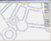
If you want to edit a Raster file in your CAD program, you first have to convert it to a vector file. AbleTracer does just that, transforming scanned paper drawings into a vector format. It looks like a typical graphics program, with toolbars and floating palettes, you can edit Raster image, vectorize it and edit the vector drawing. AbleTracer also offers TWAIN support for...
Category: Multimedia & Design / Image Editing
Publisher: AbleTracer Development, License: Shareware, Price: USD $79.95, EUR57.11, File Size: 2.4 MB
Platform: Windows
Software development kit for CAD/CAM/ GIS and graphic software developers.
Software development kit for CAD/CAM/ GIS and graphic software developers. Converts from Raster to vector and refines architect, mechanical, tech drawing, Maps, math graphs, graphics for books and journals and more. ActiveX and Com Component are also available. Refines vector graphics, creates fine lines and shapes. Scanned drawings are recognized and represented in a vector...
Category: Software Development / Tools & Editors
Publisher: AlgoLab Inc., License: Shareware, Price: USD $0.00, File Size: 2.7 MB
Platform: Windows
This software development kit (SDK) provides the binaries and programming reference for the Bing Maps Silverlight Control. You can use this control to build your own web sites that use Bing Maps.
The Bing Maps Silverlight Control combines the power of Silverlight and Bing Maps to provide an enhanced mapping experience. Developers can use the Bing...
Category: Utilities / Misc. Utilities
Publisher: Microsoft, License: Freeware, Price: USD $0.00, File Size: 3.8 MB
Platform: Windows
Dachinko is a casual game inspired by the culture of ancient Asia and pachinko machines.
Dachinko is a casual game inspired by the culture of ancient Asia and pachinko machines. 55 unique machines in a classic mode and some more in a bonus mode guarantee great fun for a long time. Moreover, each of six stages of classic mode is rewarded with a Chinese shadow theatre performance.
Platform requirements:
OS: Win9x/ME/NT/2000/XP/Vista/7; Memory: 512 MB;...
Category: Games / Action
Publisher: Gamecask, License: Shareware, Price: USD $6.99, File Size: 27.9 MB
Platform: Windows
GTXImage CAD is a total Raster and vector drawing system for bringing paper drawings into a modern CAD, EDM or GIS environment. It includes powerful, industry standard two-dimensional CAD functionality that fully supports comprehensive hybrid Raster and vector capabilities. It also provides highly efficient Raster enhancement and editing features that permit you to make the...
Category: Multimedia & Design / Image Editing
Publisher: GTX, License: Freeware, Price: USD $0.00, File Size: 248.0 MB
Platform: Windows
REDIPlus provides a single platform for seamless order routing of Equities, Futures and Options across the Americas, Europe and Asia. Portfolio Trader provides institutional traders with the workflow tools, analytics and global reach to execute portfolios of securities seamlessly across asset classes.You can trade single contracts and complex spreads in the Option Series window and more
Category: Business & Finance / Small Business Tools
Publisher: Goldman Sachs, License: Demo, Price: USD $0.00, File Size: 13.7 KB
Platform: Windows