Free Downloads: Road And Grid Coordinates
The CooRecorder program is used for registration of coordinates taken from images.
The CooRecorder program is used for registration of Coordinates taken from images.
You can use your computer scanner to take interesting photos of things which can be placed on the top of your scanner. If the things are transparent and small, they can be taped up on transparent film and then inserted into a film scanner. An image scanned as a photo from such a thing can be...
Category: Home & Education / Science
Publisher: Cybis Elektronik & Data AB, License: Shareware, Price: USD $68.00, File Size: 0
Platform: Windows
Design Grid is an easy to use design tool.
Design Grid is an easy to use design tool. The program allows you to control the sizes and proportions in your design. It has an austere design with auto-hide controls.
Design Grid will be useful in designing user interfaces, web interfaces, graphic elements, for photo editing and analyzing graphs.
You can download and try program for free!
Category: Multimedia & Design / Multimedia App's
Publisher: Softaddress, License: Shareware, Price: USD $19.95, File Size: 928.0 KB
Platform: Windows
FlashPoints is a tool for creating and managing points Groups (topographic points for example). FlashPoints allows you to : * import/export points Coordinates from and to a file * create points and their attributes "Number", "Elevation" and "Description" by clicking * modify the points elevation * modify the height and rotation of the attributes * create...
Category: Multimedia & Design
Publisher: DeliCAD, License: Shareware, Price: USD $49.00, File Size: 1.2 MB
Platform: Windows
Do you have coordinates for some places of interest?
Do you have Coordinates for some places of interest? Do you want to find them on Earth's surface? There are more than 2,000 coordinate systems available to make Google Earth follow your interests! Plex.Mark! simply placemarks your world!
Have you found a place in Google Earth and you would like to have the Coordinates in your coordinate system? Plex.Mark! will now make...
Category: Internet / Browser Accessories
Publisher: Plexscape, License: Freeware, Price: USD $0.00, File Size: 601.9 KB
Platform: Windows
Fura is a self-contained Grid middleware that allows the Grid enablement and distribution of applications on heterogeneous computational resources. Fura features a web-based GUI, wizard-guided installation and configuration, and Web Services compliance.
Fura is for developers or highly technical enthusiasts who want the open and latest Grid technology early and often...
Category: Business & Finance / Business Finance
Publisher: FuraJedi, GFA, GSsystems, License: Shareware, Price: USD $0.00, File Size: 34.5 MB
Platform: Windows
With this FREE AutoCAD add-on you can create terrain sections
from geodetic points(heights) in the drawing. You can also
specify position of pipe(cable, Road, ...) or set auxiliary
marks in the section.
Text settings, scale in X,Y axis, height of the reference
plane and type of the terrain section can be set at start-up.
There are two ways how you can create...
Category: Multimedia & Design / Multimedia App's
Publisher: Cadhedral, License: Freeware, Price: USD $0.00, File Size: 69.0 KB
Platform: Windows
 Shareware
The Eye4Software Coordinate Calculator is an easy to use tool to perform map or GPS coordinate conversions. The software can be used to transform a single coordinate or a batch of Coordinates read from a comma separated, database or ESRI shapefiles. The software is shipped with a MS Access database file, containing more then 3500 ellipsoid, map datum and map Grid definitions...
Category: Business & Finance / Calculators
Publisher: Eye4Software B.V., License: Shareware, Price: USD $49.00, EUR39, File Size: 3.2 MB
Platform: Windows
Defense Grid: Gold is the bundle including DG: The Awakening, DG: Borderlands, and DG: Resurgence all in one package. All this three Defense Grid games will offer you a memorable experience. Defense Grid: The Awakening is a unique spin on tower defense gameplay that will appeal to players of all skill levels.
Category: Games / Arcade
Publisher: Hidden Path Entertainment, License: Shareware, Price: USD $6.99, File Size: 1024.0 MB
Platform: Windows
Archim is a program for drawing the graphs of all kinds of functions. You can define a graph explicitly and parametrically, in polar and spherical Coordinates, on a plane and in space (surface). Archim will be useful for teachers and students, as well as for everyone who is interested min geometry. With Archim, you will draw the graph of any function and form, just use your imagination....
Category: Home & Education
Publisher: Stochastic Lab, License: Freeware, Price: USD $0.00, File Size: 479.6 KB
Platform: Windows
A!K Mouse Off-Road is an odometer for your mouse! It tracks movement of the mouse and the time of a mouse activity. All tracked information is shown on the indicator window and may be exported to a .txt file.
Category: Desktop Enhancements
Publisher: sixfiles.com, License: Freeware, Price: USD $0.00, File Size: 474.0 KB
Platform: Windows, Mac, 2K, 2K3
This program calculates the location of almost any tipe of locator.
This program calculates the location of almost any tipe of locator. It also calculates the distance, azimuth, longitude and latitude betweent two locators. The software converts latitude/longitude Coordinates to Maidenhead locators and vice versa. It converts IARU locator and longitude/latitude Coordinates ti UI-View format Coordinates.
Category: Home & Education / Miscellaneous
Publisher: ON6MU Group, License: Freeware, Price: USD $0.00, File Size: 367.8 KB
Platform: Windows
The goal of Road Construction is to build a Road to connect two neighboring cities so that a first vehicle, ready to start on your heels at the beginning of the game, can reach its goal. The vehicle has to run a minimum given distance. As anybody knows, more the Road is long and loopy and more it costs money and better paid is the contractor. You arrange blocks of different...
Category: Games / Arcade
Publisher: TLK Games, License: Shareware, Price: USD $5.95, File Size: 2.2 MB
Platform: Windows
FSM Moving Map is a Freeware software with some neat features.
FSM Moving Map is a Freeware software with some neat features. With proper Road maps, you will be able to find your Road (or lack of) in FS environment, or fly at ease using Sectional or terminal charts.
The concept is very simple: you, the user define all the maps once you are flying, FSMMM will try to locate the best map available, and display it on screen. Here is...
Category: Home & Education / Miscellaneous
Publisher: RanaInside, License: Freeware, Price: USD $0.00, File Size: 1.1 MB
Platform: Windows
The Software for Filling Out Any Forms (e.
The Software for Filling Out Any Forms (e.g. pre-printed forms, business forms, government forms, images of electronic forms in Word or PDF etc)
If you are searching for form filler software, you have found it --- FarFast Form Filler, the fastest form filler on the market.
Features:
- The preprinted form filler software program is able to display the form image in the top...
Category: Utilities / System Utilities
Publisher: HexaTech, License: Freeware, Price: USD $0.00, File Size: 2.3 MB
Platform: Windows
The Elegant Grid is a set of feature-rich and extensible .
The Elegant Grid is a set of feature-rich and extensible .NET components designed to help developers easily create the presentation layer of table and hierarchical data for professional Windows Forms applications. The Grid architecture is designed to be conceptually compatible with all the Windows Forms elements including DataGridView.
Category: Home & Education / Miscellaneous
Publisher: FOSS Software, Inc., License: Shareware, Price: USD $95.00, File Size: 8.4 MB
Platform: Windows
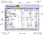
This java Data Grid Control applet enables the display of data in rows and columns in java & web applications. Powerful features include Fast Sorting, Data Acquisition, URL Hyperlinks, Embedded Images, Column Totalling and much more. Enables Dynamic interaction with other page components via JavaScript and special methods. The java data Grid component is very efficient, at just 19...
Category: Business & Finance
Publisher: Sirius Computer Consultants Limited, License: Shareware, Price: USD $49.00, File Size: 182.4 KB
Platform: Windows, Linux, OS/2, Mac, Unix, MS-DOS
Dapfor.Net Grid is a specialized control that displays data as a series of rows and columns known as a tabular format.Originally the Grid was designed for electronic financial markets with their stringent requirements to robustness, low consumption of memory and CPU resources, ergonomic and simple user interface and rich API.
Category: Business & Finance / Business Finance
Publisher: Dapfor, License: Shareware, Price: USD $695.50, File Size: 23.1 MB
Platform: Windows
SemGrid (Simple easy manager of Grid data, for SEMoLa).
SemGrid (Simple easy manager of Grid data, for SEMoLa). Some of its features are: Freeware raster GIS, for Windows OS, import and export of Grid layers from ASCII Grid files of Surfer (grd), GeoMedia (asc), ArcGis (asc) and binary or ASCII from Idrisi32 (rdc, rst), GeoEAS, GRASS, map algebra, Markov chains estimation and simulation and much more.
Category: Business & Finance / Applications
Publisher: Francesco Danuso, University of Udine, License: Freeware, Price: USD $0.00, File Size: 7.9 MB
Platform: Windows
Shareware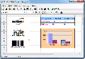
FlexCell is a flexible and easy to use Grid control. Using FlexCell Grid Control, you can create the professional user interfaces and report form in your application. FlexCell Grid Control provides comprehensive functions such as Print, Print Preview, Chart, Merge Cell, Virtual Grid, Sort, Import (from) and Export (to) XML, Export to Excel Workbook (no need of...
Category: Software Development
Publisher: FlexCell Technologies, License: Shareware, Price: USD $129.00, File Size: 2.4 MB
Platform: Windows
Demo
DXF Works is an application that allows to extract Coordinates and other various data from DXF files. You can choose which entities to process and which data to extract, creating your own file format. DXF Works can process several files at one time and lets save your settings in reusable configuration files. DXF Works can be used for several purposes : extracting Coordinates,...
Category: Multimedia & Design / Graphics Viewers
Publisher: DeliCAD, License: Demo, Price: USD $49.00, EUR49, File Size: 783.4 KB
Platform: Windows
The VB Image Map OCX is an ActiveX Control designed to provide your applications with the ability to display interactive images. Hotspots, or specially designated areas on your image, can be defined that will react to various mouse events. It is easily integrated into your existing applications - just drop the control on a form, assign a background picture, and assign the hotspot...
Category: Software Development / Tools & Editors
Publisher: Silverband Software, License: Demo, Price: USD $49.95, File Size: 512.0 KB
Platform: Windows
Lighting Grid Game is a free and nice board game with some nice features.
Lighting Grid Game is a free and nice board game with some nice features.
It is a small but funny game.Click on a Grid, it will be surrounded by four Grid of colors from white to black or from black to white. Check all changed when the 25 Black, the game victory! Come on!
Category: Games / Misc. Games
Publisher: 365freesoft.com, License: Freeware, Price: USD $0.00, File Size: 1.0 MB
Platform: Windows

TRANSDAT geosoftware executes coordinate transformations and geodetic datum shifts between many coordinate and reference systems of America, Australasia, Europe, Germany special and world-wide, with high precision and high speed: 1.The current and historical coordinate and reference systems of all countries of the European Union (EU) including the eastern extensions and the systems of non-EU...
Category: Home & Education / Science
Publisher: Killet Software Ing.-GbR, License: Shareware, Price: USD $170.00, EUR160, File Size: 4.4 MB
Platform: Windows
Looking for an awesome arcade-style off-road racer that is just plain fun to drive?
Looking for an awesome arcade-style off-Road racer that is just plain fun to drive? Then put the pedal to the metal with Off Road Arena! This is the recipe for fun and excitement: Mix one part burnin'speed, 2 parts dirt and mud, and 3 parts adrenaline and you get the most exhilarating indoor racer that you have ever seen! With professionally designed tracks and two distinct...
Category: Games / Action
Publisher: Oberon Media, License: Shareware, Price: USD $6.95, File Size: 23.4 KB
Platform: Windows
The Balloon Browser recognizes and highlights geo-coordinates in web pages.
The Balloon Browser recognizes and highlights geo-Coordinates in web pages. Hovering over a recognized location advises another application to show a map of the corresponding area. For now the only program Balloon Browser can interact with is Google Earth.
Instead of waiting for the one true geo-notation and markup standard, Balloon Browser tries to parse a variety of common...
Category: Internet / Browsers
Publisher: Michael Krause, License: Freeware, Price: USD $0.00, File Size: 5.6 MB
Platform: Windows