Free Downloads: Satellites Coordinates
The VB Image Map OCX is an ActiveX Control designed to provide your applications with the ability to display interactive images. Hotspots, or specially designated areas on your image, can be defined that will react to various mouse events. It is easily integrated into your existing applications - just drop the control on a form, assign a background picture, and assign the hotspot...
Category: Software Development / Tools & Editors
Publisher: Silverband Software, License: Demo, Price: USD $49.95, File Size: 512.0 KB
Platform: Windows
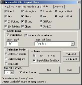
You can enter your City/State OR Zipcode and it outputs a lot of useful information like Azimuth, Elevation, Latitude, Longitude, and Magnetic Deviation. It also has a text database for the Satellites that makes it easy to modify satellite names and easy to add or delete Satellites.
Category: Home & Education / Miscellaneous
Publisher: NeuroSoft, License: Freeware, Price: USD $0.00, File Size: 1.6 MB
Platform: Windows
The Balloon Browser recognizes and highlights geo-coordinates in web pages.
The Balloon Browser recognizes and highlights geo-Coordinates in web pages. Hovering over a recognized location advises another application to show a map of the corresponding area. For now the only program Balloon Browser can interact with is Google Earth.
Instead of waiting for the one true geo-notation and markup standard, Balloon Browser tries to parse a variety of common...
Category: Internet / Browsers
Publisher: Michael Krause, License: Freeware, Price: USD $0.00, File Size: 5.6 MB
Platform: Windows

For the area of the Federal Republic of Germany more than 2,7 million street Coordinates with a coverage of 100% are available. The geo data offered here are in high-precision quality and are present in different coordinate and reference systems. Street Coordinates or also called street section Coordinates are meaning the summary of several postal house addresses to an...
Category: Business & Finance
Publisher: C. Killet Software Ing.-GbR, License: Demo, Price: USD $625.00, File Size: 68.4 KB
Platform: Unknown
For many countries house coordinates are present with coverage degrees upto 100 percent.
For many countries house Coordinates are present with coverage degrees upto 100 percent. The geo data offered here are in high-precision quality and are present in different coordinate and reference systems. House Coordinates or also called Geo Coded Building Addresses are meaning the connection between the postal addresses of buildings or building complexes and their accurate...
Category: Business & Finance / Database Management
Publisher: C. Killet Software Ing.-GbR, License: Demo, Price: USD $1420.00, File Size: 234.0 KB
Platform: Windows
The Weather Globe screen saver accesses our servers several times an hour for updated weather information which is automatically uploaded. Weather is downloaded from NOAA (the National Oceanic and Atmospheric Administration) where it is mapped into polar Coordinates on our servers and uploaded to the globe that you see in your screen saver. The weather current within 2 hours. Since this...
Category: Desktop Enhancements / Screensavers
Publisher: PBHLLC, License: Freeware, Price: USD $0.00, File Size: 837.0 KB
Platform: Windows

For the area of the Federal Republic of Germany more than 2,7 million street Coordinates with a coverage of 100% are available. The geo data offered here are in high-precision quality and are present in different coordinate and reference systems. Street Coordinates or also called street section Coordinates are meaning the summary of several postal house addresses to an...
Category: Business & Finance
Publisher: C. Killet Software Ing.-GbR, License: Demo, Price: USD $625.00, File Size: 68.4 KB
Platform: Unknown
For the area of the Federal Republic of Germany more than 19 million House Coordinates with a coverage of 100% are available. The geo data offered here are in high-precision quality and are present in different coordinate and reference systems. House Coordinates are the cartographically representable positions of buildings, which are defined by their postal addresses. They are...
Category: Business & Finance
Publisher: C. Killet Software Ing.-GbR, License: Demo, Price: USD $1250.00, File Size: 111.7 KB
Platform: Unknown

For the area of the Federal Republic of Germany more than 19 million House Coordinates with a coverage of 100% are available. The geo data offered here are in high-precision quality and are present in different coordinate and reference systems. House Coordinates are the cartographically representable positions of buildings, which are defined by their postal addresses. They are...
Category: Software Development
Publisher: C. Killet Software Ing.-GbR, License: Demo, Price: USD $1250.00, File Size: 111.7 KB
Platform: Unknown
The Swath Acquisition Viewer (SaVoir) is a Windows stand-alone application for analyzing potential remote sensing opportunities from earth observation Satellites.By combining each satellite's orbit, sensor field of view geometry and the shape and location of a user-defined area of interest, SaVoir can determine the exact times when a satellite would be capable of observing the...
Category: Business & Finance / MS Office Addons
Publisher: Taitus Software Italia srl, License: Shareware, Price: USD $5247.00, File Size: 44.6 MB
Platform: Windows
It is a little utility to automate the reception of the APT signal transmitted by the low orbit Weather Satellites. It will:
Set the receiver to the correct frequency just before the satellite pass (using a serial connection).
Record the audio signal during the pass. (Using the line in input of the sound card). Create overlay for pass using David Taylor's WXtrack.
...
Category: Business & Finance / Applications
Publisher: K.S., License: Freeware, Price: USD $0.00, File Size: 43.4 KB
Platform: Windows
Win your way to the city that never sleeps with $13,000 Main Event and $2,500 Vegas Spree Satellites.
Win as many of these prize packages as you like and you'll be enjoying all the luxuries Sin City has to offer. Qualify today for as little as $1.10
Match your Gold Cards to our June game board to win cash, tournament tickets and gold chips!
...
Category: Games / Cards, Casino, Lottery
Publisher: Dimeline Sports, License: Demo, Price: USD $0.00, File Size: 15.6 MB
Platform: Windows
For many countries house Coordinates are present with coverage degrees upto 100 percent. The geo data offered here are in high-precision quality and are present in different coordinate and reference systems. House Coordinates or also called Geo Coded Building Addresses are meaning the connection between the postal addresses of buildings and their accurate positions. The house...
Category: Business & Finance
Publisher: C. Killet Software Ing.-GbR, License: Demo, Price: USD $1250.00, File Size: 111.7 KB
Platform: Unknown
If you have an R2FX, R2ZX, R139 or RX2 receiver, you may have wanted to control it from your computer so that important passes were collected, and not ruined by other Satellites capturing the receiver. My PassControl program allows this scheduling, and being RS232-based, it works under Windows XP, 2000, NT etc. as well as Windows 98 and ME.
Category: Utilities / Misc. Utilities
Publisher: SatSignal Software, License: Freeware, Price: USD $0.00, File Size: 813.4 KB
Platform: Windows
For many countries street Coordinates are present with coverage degrees upto 100 percent. The geo data offered here are in high-precision quality and are present in different coordinate and reference systems. Street Coordinates or also called street section Coordinates are meaning the summary of several postal house addresses to an averaged position on street or street...
Category: Business & Finance
Publisher: C. Killet Software Ing.-GbR, License: Demo, Price: USD $625.00, File Size: 66.6 KB
Platform: Unknown
In TruView, users can extract real 3D coordinates and accurately measure distances.
In TruView, users can extract real 3D Coordinates and accurately measure distances. Results appear right on the point cloud image. Markups are also easy to create, save and share with your peers, your service provider, or with clients for more effective communications.
Category: Audio / Utilities & Plug-Ins
Publisher: Leica Geosystems, License: Freeware, Price: USD $0.00, File Size: 7.9 MB
Platform: Windows
ThinkVantage GPS (Global Positioning System) receives signals from the GPS Satellites and determines the location of your ThinkPad. This program is easy to install and easy to manipulate.
Category: Utilities / System Utilities
This package installs the software (GPS driver) to enable the following devices:
- Ericsson F3507g
- Ericsson F3607gw
- Ericsson F5521gw
- Qualcomm HS-USB
Publisher: Lenovo, License: Freeware, Price: USD $0.00, File Size: 20.6 MB
Platform: Windows

InnerSoft CAD is a add-on for AutoCAD. This group of tools will allows you to: Export to a Excel Sheet the values of Area/Length property or Coordinates for various AutoCAD entities. Import from a Excel Sheet the vertex Coordinates for a set of 2D polylines or 3D polylines (you can choose between 3 different methods). You can also import a set of points from Excel or a set of...
Category: Multimedia & Design
Publisher: InnerSoft, License: Demo, Price: USD $100.00, File Size: 430.9 KB
Platform: Windows

InnerSoft CAD is a add-on for AutoCAD. This group of tools will allows you to: Export to a Excel Sheet the values of Area/Length property or Coordinates for various AutoCAD entities. Import from a Excel Sheet the vertex Coordinates for a set of 2D polylines or 3D polylines (you can choose between 3 different methods). You can also import a set of points from Excel or a set of...
Category: Multimedia & Design
Publisher: InnerSoft, License: Demo, Price: USD $100.00, File Size: 444.0 KB
Platform: Windows
The program produces a set with seven parameters of the sapatial Helmert transformation valid for an specific area, with which then arbitrary Coordinates of the area can be transformed from one reference system into another with high accuracy. The seven transformation parameters are computed with a set of individual identical points. Those are points with known Coordinates in both...
Category: Business & Finance / Calculators
Publisher: Killet Softwareentwicklung GbR, License: Shareware, Price: USD $170.00, File Size: 1.8 MB
Platform: Windows
The navigation device is a kind of mini computer which contains a GPS satellite navigation receiver.
The navigation device is a kind of mini computer which contains a GPS satellite navigation receiver. This allows the device to determine its current position. At least 4 Satellites need to be received in order to be able to perform acceptable navigation. The fifth satellite is required to obtain an altitude. As navigation takes place in a dynamic state, there is scarcely any constant...
Category: Business & Finance / Business Finance
Publisher: United Navigation, License: Freeware, Price: USD $0.00, File Size: 13.8 MB
Platform: Windows