Free Downloads: Scanned Map Creator

GPS Navigator with using a Scanned maps and possibility to open a lot of maps together. - you can show a current GPS data (Speed, Direction, Longitude, Latitude, Time, Date, Height); - you can open any of Scanned maps (in a "bmp" or "dib" format); - you can calibrate the Scanned maps yourself by two calibration points only (left-top and right-bottom); -...
Category: Home & Education
Publisher: Valeri Vlassov, License: Demo, Price: USD $19.00, File Size: 4.6 MB
Platform: Windows
Cool Flash Map Maker is a powerful Flash Map software for developing interactive flash mapping solutions and products for Real Estate, Spacial Statistics, Business Locator Applications, Vector USA Map,World Map, Germany Map,ASIA Map, Canada Map, Europe Map, Australia Map, Austria Map, Africa Map, UK Map, South...
Category: Multimedia & Design / Multimedia App's
Publisher: Go2Share, License: Shareware, Price: USD $29.95, File Size: 17.9 MB
Platform: Windows
Advanced Curve Creator is add-on software to AutoCAD, MAP or Civil3D, (2007, 2008, 2009).
Advanced Curve Creator is add-on software to AutoCAD, Map or Civil3D, (2007, 2008, 2009). The Advanced Curve Creator (ACC) allows you to plot 2D mathematical functions in the AutoCAD environment as polylines. Mathematical expressions can be set in three forms: explicit (Cartesian), explicit (polar) and parametric (Cartesian).Curves are defined using formula editor where...
Category: Multimedia & Design / Multimedia App's
Publisher: CADdicted inc., License: Shareware, Price: USD $24.00, File Size: 614.4 KB
Platform: Windows
AutoDEM (aka as AutoMNT) is a freeware GIS software to create Digital Elevation Models (DEM) from Scanned topographic maps for Windows.
Through different data layers (Map, contours, DEM, etc.), AutoDEM provides many tools for :
-Topographic Map analysis
-Contour lines extraction and reconstruction
-Contours to DEM interpolation and DEM analysis
...
Category: Multimedia & Design / Animation
Publisher: Joachim Pouderoux, License: Freeware, Price: USD $0.00, File Size: 27.6 MB
Platform: Windows
 Shareware
Scanned Image to Word Converter can be used to convert scanned image to Word document.
Scanned Image to Word Converter can be downloaded for free and trial version of the application is free of charge. Features of Scanned Image to Word Converter: 1.Support Windows 2000 and later systems of both 32bit and 64bit. 2.Convert Scanned PDF files to editable Word or RTF documents in batch. 3.Convert Scanned image files to editable Word or RTF documents...
Category: Business & Finance / Business Finance
Publisher: VeryPDF.com Inc, License: Shareware, Price: USD $79.95, AED100, File Size: 15.1 MB
Platform: Windows
Advanced Curve Creator is add-on software to AutoCAD, MAP or Civil3D, (2007, 2008, 2009).
Advanced Curve Creator is add-on software to AutoCAD, Map or Civil3D, (2007, 2008, 2009). The Advanced Layout Creator (ALC) allows you to plot any model space rectangular area to layout. User can define model space scale and final layout scale. User have different options to draw model space rectangles: one by one with user-friendly rotation options or to draw array of...
Category: Multimedia & Design / Multimedia App's
Publisher: CADdicted inc., License: Shareware, Price: USD $24.00, File Size: 614.4 KB
Platform: Windows
This program is a tool for stretching a bitmap image (a raster image), trimming it to a box, and calibrating it. This is primarily of use when dealing with a Scanned image of a paper Map. Often when making a scan it is hard to get the image precisely aligned; sometimes with old maps the paper has stretched. It can be useful where you want to make a tiled Map from a number...
Category: Multimedia & Design / Multimedia App's
Publisher: Map Library, License: Freeware, Price: USD $0.00, File Size: 755.8 KB
Platform: Windows
DigiMap is a graphical program for simple digitization of Map data to create ASCI files of ordered x,y,z triplets. It is a quick and easy alternative to expensive digitizing tablets and software. Maps (such as geological, topographic, structural, or isopach) in common Windows file formats (JPEG, PNG, TIFF, PCX, TGA, BMP, WMF, EMF, PSD, GIF) can be opened or Scanned in DigiMap and...
Category: Multimedia & Design / Fonts
Publisher: KWare (Ken Wohletz), License: Freeware, Price: USD $0.00, File Size: 8.4 MB
Platform: Windows
OziExplorer is a flamboyant GPS Mapping Software that runs on the PC and works with varieties of GPS receivers such as Garmin, Lowrance, Magellan, Eagle, Brunton, Silva and MLR for the uploading or downloading the waypoints, routes and tracks and most brands of GPS receivers for real time tracking of GPS position.
Using this software, the user can use maps and charts that can be...
Category: Internet / Communications
Publisher: Des Newman, License: Shareware, Price: USD $95.00, File Size: 6.8 MB
Platform: Windows
Remere's Map Editor is a map editor for the OpenTibia Project which was created by Remere.
Remere's Map Editor is a Map editor for the OpenTibia Project which was created by Remere.
Remere's Map Editor is a Map editor coded in C to be used with OpenTibia. It supports many advanced features such as autobordering and placing of composite objects. Runs under both Linux and Windows using wxWidgets and OpenGL.
Category: Games / Tools & Editors
Publisher: Remere, License: Shareware, Price: USD $0.00, File Size: 4.2 MB
Platform: Windows
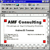
NEW! Business Card Creator version 3.2 for Word for Windows and Macintosh is a complete do-it-yourself package. Easily create beautiful, full-color, professional business cards in just minutes. Create a design that suits you and your business, the way you want when you want it and when you need them! It's easy to create as many or as few as you need! Easily add customized logos,...
Category: Business & Finance / Applications
Publisher: Andrew Freeman, License: Shareware, Price: USD $15.00, File Size: 825.0 KB
Platform: Unknown
Freeware
An interactive Flash USA Map with all the features you need for your web site or project. This is the ideal solution for dealer maps, real-estate listings, or visualizing state statistics. Nearly every aspect of the Map is customizable. However, unlike competing products, our Map is very simple to install and edit. Just upload XML and SWF files and embed.
Category: Internet / Flash Tools
Publisher: http://www.flashusamap.com/trial/flashus, License: Freeware, Price: USD $0.00, File Size: 93.8 KB
Platform: Unknown
Map of Africa is one of the many maps created for GPS TrackMaker.
Map of Africa is one of the many maps created for GPS TrackMaker. You are able to download the installation package from the TrackMaker website. In order to preview the contents of this package, you need to install GPS TrackMaker.
Using the above mentioned application, you will be able to see the Map of Africa. Just click on the "Open Temporary...
Category: Home & Education / Miscellaneous
Publisher: Geo Studio Technology, License: Freeware, Price: USD $0.00, File Size: 18.3 MB
Platform: Windows
Shareware
Scanned Image to DOC Converter nearly supports all the common image file format like TIFF, JPG, PNG, BMP, TGA, PCX, EMF, WMF and PNM. Features of Scanned Image to DOC Converter: 1.Support Windows 2000 and later systems of both 32bit and 64bit. 2.Convert Scanned PDF files to editable Word or RTF documents in batch. 3.Allow selecting page range of Scanned PDF...
Category: Business & Finance / Business Finance
Publisher: VeryPDF.com Inc, License: Shareware, Price: USD $79.95, AED100, File Size: 15.1 MB
Platform: Windows
Site Mapper will analyze the contents of a web site, and create a detailed Map with an indexed listing of all resources by page and category.
Features:
- Spellcheck documents as they are mapped
- Built in document preview functionality
- Integrates with your favorite document editor
- Functions with local and online files
- Save files to...
Category: Web Authoring / Web Design Utilities
Publisher: Trellian, License: Freeware, Price: USD $0.00, File Size: 2.4 MB
Platform: Windows
Program shows you an actual X3 sector-map, with detailed information about most in-game objects.
Program shows you an actual X3 sector-Map, with detailed information about most in-game objects. The Map is based on a log-file that is created with an in-game script (by Andrei[<>Ace]). If you just want to view the standard Map (or if you don’t have the game) the program will work with the included default Map, which was created with an English X3 game...
Category: Games / Misc. Games
Publisher: SUU Design, License: Freeware, Price: USD $0.00, File Size: 1.4 MB
Platform: Windows
New Zealand Map Reference Converter (NZMapConv) is software that LINZ provides to convert Map references between the old NZMS260 Map series and the new NZTopo50 Map series.NZMapConv is a Windows programme designed to convert individual coordinates entered manually.
Category: Multimedia & Design / Media Management
Publisher: Land Information New Zealand, License: Freeware, Price: USD $0.00, File Size: 2.4 MB
Platform: Windows
When the XMAP software is communicating with an XEDE via the comms cable each Map will show, at the top of the Map display, an RPM and load value (x and y axis for the Map) in real time. Also in each Map a yellow highlighted block will show the current position within the Map. Beside the real-time display on each Map are the undo and redo buttons which...
Category: Home & Education / Miscellaneous
Publisher: ChipTorque, License: Freeware, Price: USD $0.00, File Size: 1.7 MB
Platform: Windows
Sig Panama Has :
Digital maps of Panama, Digital Map of Panama-City, digital Map of Taboga, digital Map of Bocas del Toro, digital Map of Colon and Free Zone, digital Map of Contadora Island, digital Map of Coronado, Panama, Zona Libre, Map of Panama, Map of Panama City, Map of Colon, Map of Zona Libre, Map of...
Category: Internet / Misc. Plugins
Publisher: DP Imperial, LLC., License: Freeware, Price: USD $0.00, File Size: 44.9 MB
Platform: Windows
CaptureOnTouch is a scanning application for imageFORMULA DR-2510C.
CaptureOnTouch is a scanning application for imageFORMULA DR-2510C.
It is provided with two scanning methods: [Scan First] and [Select Scan Job]. Scanned images are processed in accordance with the selected output method.
DR-2510C CaptureOnTouch has four output methods for processing a Scanned image.
- Save to folder: Save the Scanned...
Category: Utilities / Misc. Utilities
Publisher: Canon Electronics, License: Freeware, Price: USD $0.00, File Size: 74.9 MB
Platform: Windows
ChipFinder will find if exactly same file is in the crypted database, it can make chip for an unknown file basing of knowledge Scanned from your other files, even if maps are moved etc. If you find that the file needs some corrections, you can do simple and convenient Map editing (like add fuel or raise boost etc.)
Category: Business & Finance / Business Finance
Publisher: ECUsafe, License: Demo, Price: USD $0.00, File Size: 364.2 KB
Platform: Windows
Freeware
Arm Map Explorer recreates all the functionalities of Google Maps on your desktop while expanding them with new extras. Map Explorer lets you locate and view any place on the planet using dynamic interactive maps. These maps are draggable, which means there is no need for you to click and wait for graphics to reload each time you want to view adjacent parts of a Map....
Category: Internet / Flash Tools
Publisher: ArmCode, License: Freeware, Price: USD $0.00, File Size: 5.5 MB
Platform: Windows
FilePDF is a complete PDF creator and editor.
FilePDF is a complete PDF Creator and editor. Especially designed to work with Scanned documents, you can apply OCR technology to your newly acquired documents to retrieve the full text, edit it, and save it as a PDF document. You can make your Scanned PDF files searchable and indexable, and also split and merge existing PDFs.
You can use FilePDF as a PDF...
Category: Utilities / System Utilities
Publisher: Lucion Technologies, LLC, License: Shareware, Price: USD $69.95, File Size: 61.2 MB
Platform: Windows
Shareware
GPS Mapping Software for Windows, Loading topographic maps, realtime navigation, track recording, manage GPS devices and more. The software can be used with various Map formats including: GeoTiff, BSB Nautical Charts, AutoCad DXF files, ESRI Shapefiles. Using calibration you can also use Scanned or downloaded JPG, BMP, GIF, PNG and TIF maps. The software can be used for survey,...
Category: Home & Education / Science
Publisher: Eye4Software B.V., License: Shareware, Price: USD $149.00, EUR99, File Size: 11.1 MB
Platform: Windows
Time Zones Map is the flash world time Map featuring the time peculiarities of more then 50 cities all over the world. Its eye-catching but still pleasant design, varied functions and multiple application abilities combine everything the ultra-modern flash world time Map must have. You can put our Time Zone Map either on one of your website?s pages or put a banner,...
Category: Web Authoring / Flash Utilities
Publisher: USFlashMap.com, License: Shareware, Price: USD $249.00, File Size: 45.0 KB
Platform: Windows, Mac, Linux, Unix, MS-DOS, AS, 400