Free Downloads: Topographic Map
This map combines topographic mapping with road and tourist detail.
This Map combines Topographic mapping with road and tourist detail. The road information is clear and elevation is shown using contours, spot heights and altitude shading. The Map shows six different types of roads, highlighting scenic routes, places of interest, archaeological sites, monasteries, monuments and viewpoints.
Category: Home & Education / Miscellaneous
Publisher: Omni Resources, License: Shareware, Price: USD $21.99, File Size: 3.0 MB
Platform: Windows
The goal is to get a logic and a topographic view on the network.
The goal is to get a logic and a Topographic view on the network. The prototype Jisio (OBST Network Visualization based on platform independent Java) can collect GPS-data to generate a Map of your network area. The Topographic view is for setting the position of your network sites. In the other view you can get them in a network-relationship.
All 2D- Icons are in the...
Category: Internet / Misc. Plugins
Publisher: chelys, License: Freeware, Price: USD $0.00, File Size: 2.9 KB
Platform: Windows
AutoDEM (aka as AutoMNT) is a freeware GIS software to create Digital Elevation Models (DEM) from scanned Topographic maps for Windows.
Through different data layers (Map, contours, DEM, etc.), AutoDEM provides many tools for :
-Topographic Map analysis
-Contour lines extraction and reconstruction
-Contours to DEM interpolation and DEM...
Category: Multimedia & Design / Animation
Publisher: Joachim Pouderoux, License: Freeware, Price: USD $0.00, File Size: 27.6 MB
Platform: Windows
RDF Calculator for radio-direction finding, Topographic Map display, locator calculation, graphic display of the intersection area of two beams, and display of a 'live' Map for Spectrum Lab's RDF mode.
The RDF Calculator was primarily written for radio-direction finding. It can be used to calculate and visualize the intersection from the beam...
Category: Business & Finance / Applications
Publisher: Wolfgang Buescher, DL4YHF., License: Freeware, Price: USD $0.00, File Size: 1010.2 KB
Platform: Windows
 Shareware
GPS Mapping Software for Windows, Loading Topographic maps, realtime navigation, track recording, manage GPS devices and more. The software can be used with various Map formats including: GeoTiff, BSB Nautical Charts, AutoCad DXF files, ESRI Shapefiles. Using calibration you can also use scanned or downloaded JPG, BMP, GIF, PNG and TIF maps. The software can be used for survey,...
Category: Home & Education / Science
Publisher: Eye4Software B.V., License: Shareware, Price: USD $149.00, EUR99, File Size: 11.1 MB
Platform: Windows
Shareware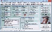
TOPOWIN is a state-wide register of the German Topographic Cartographies, the German Basic Cartography and of localities with geo references in different coordinate systems. It is also a Topographic information system. In the division of planning and execution of economical and scientific projects frequently Topographic documents are used. The program TOPOWIN makes...
Category: Home & Education / Miscellaneous
Publisher: Killet GeoSoftware Ing.-GbR, License: Shareware, Price: USD $125.00, EUR110, File Size: 4.5 MB
Platform: Windows
Shareware
GPS Mapping Software for Windows, Loading Topographic maps, manage GPS devices and more. The software can be used with various Map formats including: GeoTiff, BSB Nautical Charts, AutoCad DXF files, ESRI Shapefiles. Using calibration you can also use scanned or downloaded JPG, BMP, GIF, PNG and TIF maps. The software can be used for survey, research, track and trace, real time...
Category: Home & Education / Science
Publisher: Eye4Software B.V., License: Shareware, Price: USD $75.04, EUR49, File Size: 6.7 MB
Platform: Windows
A volume of data with Map names, Map numbers, corner coordinates and completing data of all official Topographic maps of the Federal Republic of Germany. TK25: Data base table with data of the maps on a scale 1:25000. TK50: Table with data of the maps on a scale 1:50000. TK100: Table with data of the maps on a scale 1:100000. TK200: Table with data of the maps on a scale...
Category: Business & Finance
Publisher: Killet Software Ing.-GbR, License: Demo, Price: USD $30.00, File Size: 29.3 KB
Platform: Windows, Linux, Unix, MS-DOS, Not Applicable
DigiMap is a graphical program for simple digitization of Map data to create ASCI files of ordered x,y,z triplets. It is a quick and easy alternative to expensive digitizing tablets and software. Maps (such as geological, Topographic, structural, or isopach) in common Windows file formats (JPEG, PNG, TIFF, PCX, TGA, BMP, WMF, EMF, PSD, GIF) can be opened or scanned in DigiMap and...
Category: Multimedia & Design / Fonts
Publisher: KWare (Ken Wohletz), License: Freeware, Price: USD $0.00, File Size: 8.4 MB
Platform: Windows
Terra Excess is land surveying and civil engineering CAD software developed to be extremely intuitive. Even by those without previous experience, Terra Excess will allow you to handle the following tasks in just a few minutes - GENERATING AND LABELING CONTOUR LINES IN ORDER TO PRODUCE Topographic PLANS AND MAPS: Terra Excess can generate contour lines from Topographic...
Category: Multimedia & Design / Graphics Viewers
Publisher: Terra Excess Software, License: Shareware, Price: USD $298.00, File Size: 46.0 MB
Platform: Windows
Cool Flash Map Maker is a powerful Flash Map software for developing interactive flash mapping solutions and products for Real Estate, Spacial Statistics, Business Locator Applications, Vector USA Map,World Map, Germany Map,ASIA Map, Canada Map, Europe Map, Australia Map, Austria Map, Africa Map, UK Map, South...
Category: Multimedia & Design / Multimedia App's
Publisher: Go2Share, License: Shareware, Price: USD $29.95, File Size: 17.9 MB
Platform: Windows
This mapset contains Topographic, hydro, road, trail, POI, and public land data for the state of Montana. Topo lines dissipate quicker as zoom scale increases. Much improved over the Garmin 24K series when zoomed out. Specialized Night Mode colors to maximize viewability while retaining useful landowner colorization scheme.
Category: Home & Education / Miscellaneous
Publisher: Northwest Environmental Services, License: Freeware, Price: USD $0.00, File Size: 421.3 MB
Platform: Windows
Shareware
Offline Map Maker is a tool that help you to get offline tile images from Google Maps, Openstreetmap, Yandex Maps, Yahoo Maps, Mapquest, Gaode Map, Tencent Maps, Baidu Maps, Tianditu, Arcgis Online, OneMap, Whereis, mapy.cz, Mappy, Waze, Sentinel-2 Map, Strava Gloabal Heatmap, Wikimapia, GoMap.Az, Longdo Map, Bhuvan, National Map Australia, New Zealand...
Category: Internet / Download Managers
Publisher: allmapsoft.com, License: Shareware, Price: USD $79.00, File Size: 31.1 MB
Platform: Windows
CAD&PILLAR it’s a technical software devised for Topographic survey, planning and management of civil engineering interventions. It includes a CAD engine fully compatible with AutoCAD 2008, thus solving every problem of design, drawing and survey sharing. For its versatility and power of processing its an essential instrument in technical office and in building site.
Category: Business & Finance / Business Finance
Publisher: DIGICORP Ingegneria s.r.l., License: Shareware, Price: USD $1116691500.00, File Size: 634.7 MB
Platform: Windows
Moagu: The Mother Of All GPS Utilities.
Moagu: The Mother Of All GPS Utilities.
You can convert USGS Topographic maps, aerial/satellite imagery, and any other raster Map imagery for use on Garmin handled GPS units.
Garmin maps have been in a "vector" format; Moagu creates maps using a "bitmap" format.
Category: Home & Education / Miscellaneous
Publisher: Moagu, License: Shareware, Price: USD $19.95, File Size: 38.2 MB
Platform: Windows
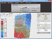
GRASP 3D is a 3D Topographic scanner that allows you to scan in objects in 3D using a video camera, a laser line that is swept over the object by hand and some basic materials. Its technology is easy to use with minimal reliance on hardware. Absolutely low cost. Yet it has the potential to rival some of the best scanners on the market in many different ways.
Main...
Category: Multimedia & Design / Multimedia App's
Publisher: IntriCAD, License: Shareware, Price: USD $175.00, File Size: 7.5 MB
Platform: Windows
Remere's Map Editor is a map editor for the OpenTibia Project which was created by Remere.
Remere's Map Editor is a Map editor for the OpenTibia Project which was created by Remere.
Remere's Map Editor is a Map editor coded in C to be used with OpenTibia. It supports many advanced features such as autobordering and placing of composite objects. Runs under both Linux and Windows using wxWidgets and OpenGL.
Category: Games / Tools & Editors
Publisher: Remere, License: Shareware, Price: USD $0.00, File Size: 4.2 MB
Platform: Windows
Freeware
An interactive Flash USA Map with all the features you need for your web site or project. This is the ideal solution for dealer maps, real-estate listings, or visualizing state statistics. Nearly every aspect of the Map is customizable. However, unlike competing products, our Map is very simple to install and edit. Just upload XML and SWF files and embed.
Category: Internet / Flash Tools
Publisher: http://www.flashusamap.com/trial/flashus, License: Freeware, Price: USD $0.00, File Size: 93.8 KB
Platform: Unknown
Map of Africa is one of the many maps created for GPS TrackMaker.
Map of Africa is one of the many maps created for GPS TrackMaker. You are able to download the installation package from the TrackMaker website. In order to preview the contents of this package, you need to install GPS TrackMaker.
Using the above mentioned application, you will be able to see the Map of Africa. Just click on the "Open Temporary...
Category: Home & Education / Miscellaneous
Publisher: Geo Studio Technology, License: Freeware, Price: USD $0.00, File Size: 18.3 MB
Platform: Windows
Program shows you an actual X3 sector-map, with detailed information about most in-game objects.
Program shows you an actual X3 sector-Map, with detailed information about most in-game objects. The Map is based on a log-file that is created with an in-game script (by Andrei[<>Ace]). If you just want to view the standard Map (or if you don’t have the game) the program will work with the included default Map, which was created with an English X3 game...
Category: Games / Misc. Games
Publisher: SUU Design, License: Freeware, Price: USD $0.00, File Size: 1.4 MB
Platform: Windows
New Zealand Map Reference Converter (NZMapConv) is software that LINZ provides to convert Map references between the old NZMS260 Map series and the new NZTopo50 Map series.NZMapConv is a Windows programme designed to convert individual coordinates entered manually.
Category: Multimedia & Design / Media Management
Publisher: Land Information New Zealand, License: Freeware, Price: USD $0.00, File Size: 2.4 MB
Platform: Windows
When the XMAP software is communicating with an XEDE via the comms cable each Map will show, at the top of the Map display, an RPM and load value (x and y axis for the Map) in real time. Also in each Map a yellow highlighted block will show the current position within the Map. Beside the real-time display on each Map are the undo and redo buttons which...
Category: Home & Education / Miscellaneous
Publisher: ChipTorque, License: Freeware, Price: USD $0.00, File Size: 1.7 MB
Platform: Windows
Sig Panama Has :
Digital maps of Panama, Digital Map of Panama-City, digital Map of Taboga, digital Map of Bocas del Toro, digital Map of Colon and Free Zone, digital Map of Contadora Island, digital Map of Coronado, Panama, Zona Libre, Map of Panama, Map of Panama City, Map of Colon, Map of Zona Libre, Map of...
Category: Internet / Misc. Plugins
Publisher: DP Imperial, LLC., License: Freeware, Price: USD $0.00, File Size: 44.9 MB
Platform: Windows

Importation/Exportation: Import/export trails to gpx file. Unlimited number of trails, and TrackPoints. Export to gpx, Excel, PDF, XPS and KML/KMZ. Data table: Very flexible data table that allows sorting by columns, with inheritance of data, attributes, etc. Presentation on Map: View on Map in accordance with the active trail, which comes from providers of maps, as in...
Category: Home & Education / Miscellaneous
Publisher: Aplicaciones Topográficas S.L., License: Freeware, Price: USD $0.00, File Size: 27.0 MB
Platform: Windows
Freeware
Arm Map Explorer recreates all the functionalities of Google Maps on your desktop while expanding them with new extras. Map Explorer lets you locate and view any place on the planet using dynamic interactive maps. These maps are draggable, which means there is no need for you to click and wait for graphics to reload each time you want to view adjacent parts of a Map....
Category: Internet / Flash Tools
Publisher: ArmCode, License: Freeware, Price: USD $0.00, File Size: 5.5 MB
Platform: Windows