Free Downloads: Mdb Shp Gis
 Shareware
Total Gis Converter is an affordable converter of Gis files. It converts AEP, GRD, ADF, E00, FLT, APR, Shp, DXF, BT, TOC, RT1, DEM, DLG, ECW, IMG, DGF, GML, SID, MIF, TAB, WOR, DNG, DDF, BIL, TIF, JPEG, TTKPS, TTKGP, TTKLS, LFT, PFT, and TFT files. The target formats are TIFF, PNG, JPEG, BMP. The program can scale your Gis files to optimize their size. Besides, it...
Category: Multimedia & Design / Graphics Viewers
Publisher: Softplicity, License: Shareware, Price: USD $99.90, File Size: 7.6 MB
Platform: Windows
Freeware
Convert ESRI ShapeFiles (.Shp) geolocation data into AnyMap format to be used with AnyChart. AnyChart Flash Map Converter allows making use of a wide choice of maps with AnyChart Flash Component, a Gis visualization system that recognizes map data in AnyMap format only. AnyChart Flash Map Converter makes it easy to visualize any geolocation data without hefty expenses associated...
Category: Web Authoring / Image Mapping Tools
Publisher: AnyChart.Com, License: Freeware, Price: USD $0.00, File Size: 1.6 MB
Platform: Windows
With this program you can read and then view geographical data contained in SHP files.
With this program you can read and then view geographical data contained in Shp files. With this program you can also view the data in the accompanying DBF database file and can save this information to SVG files. It works on Microsoft Windows 2000/XP/Vista. The program does not run on Windows 98.
Category: Business & Finance / Database Management
Publisher: Pinecoast Software, Inc., License: Freeware, Price: USD $0.00, File Size: 1.4 MB
Platform: Windows
AvisMap Gis Engine is the basic development platform for AvisMap Gis suites, which is a new generation component Gis development platform for Gis application developers. AvisMap Gis Engine 5 provides powerful Gis functions through Active X controls based on Microsoft COM component technique standards. It allows users to rapidly develop professional...
Category: Multimedia & Design / Multimedia App's
Publisher: AvisMap GIS Technologies, License: Freeware, Price: USD $0.00, File Size: 60.5 MB
Platform: Windows
DIVA-GIS is a GIS for plant biodiversity analysis.
DIVA-Gis is a Gis for plant biodiversity analysis. The project will modernize the architecture for better collaboration and extensibility based on Eclipse RCP.
DIVA-Gis can be used to map and analyze biological distribution data, such as can be provided by natural history collections and genetic resources collections. Typically, the distribution data would refer to...
Category: Business & Finance / Business Finance
Publisher: International Potato Center (CIP), License: Freeware, Price: USD $0.00, File Size: 122.4 MB
Platform: Windows
DIVA-Gis is a free computer program for mapping and geographic data analysis (a geographic information system (Gis). With DIVA-Gis you can make maps of the world, or of a very small area, using, for example, state boundaries, rivers, a satellite image, and the locations of sites where an animal species was observed.
Category: Business & Finance / Applications
Publisher: diva-gis, License: Freeware, Price: USD $0.00, File Size: 3.8 MB
Platform: Windows
The CANVAS 9 Gis Mapping Edition adds native support for Geographic Information System (Gis) data to Canvas. You can take measurements in geographic coordinates, import industry standard SHAPE and GeoTIFF files into unlimited numbers of automatically aligned overlapping layers and choose among the following options: 2,104 Coordinate Reference Systems 67 Operation Methods (like...
Category: Multimedia & Design / Multimedia App's
Publisher: ACD Systems, License: Shareware, Price: USD $549.99, File Size: 51.9 MB
Platform: Mac, PPC
The Quantum GIS Tethys repository contains a lot of software from OSGeo projects.
The Quantum Gis Tethys repository contains a lot of software from OSGeo projects. Quantum Gis Tethys and all dependencies are included, along with Python, GRASS, GDAL, etc. This is most suitable for people who want to be able to update dependencies from the Quantum Gis Tethys repository easily. The installer is able to install from internet or just download all needed...
Category: Multimedia & Design / Graphics Viewers
Publisher: QGIS Development Team, License: Freeware, Price: USD $0.00, File Size: 369.0 KB
Platform: Windows
AvisMap Gis Engine is the basic development platform for AvisMap Gis suites, which is a new generation component Gis development platform for Gis application developers.AvisMap Gis Engine Sample Projects is a bundle of sample of different projects that you can see how they work.
Category: Software Development / Misc. Programming
Publisher: AvisMap GIS Technologies, License: Shareware, Price: USD $0.00, File Size: 30.9 MB
Platform: Windows
Shareware
AvisMap Gis Engine is a comprehensive SDK for the development of custom Gis applications and solutions. This SDK provides several ActiveX (OCX) controls which support Visual Basic, VB.NET, C#, Visual C++ and other ActiveX compatible programming languages, with Microsoft Visual Studio versions 6, 2003, 2005, and Express. Supports .NET via COM. While the SDK is excellent for desktop...
Category: Software Development / Components & Libraries
Publisher: AvisMap GIS Technologies, License: Shareware, Price: USD $1199.00, File Size: 57.8 MB
Platform: Windows
Shareware
MPSuperShape is a shape manipulation tool for Microsoft MapPoint. MPSuperShape can be used to combine multiple shapes into one large shape, find the intersections (overlaps) between shapes, find boundary shapes around groups of pushpins, simplify shapes, delete multiple shapes, change shape colors, import/export shape files, and to create web pages. Import shape options include ESRI Shape...
Category: Business & Finance / Business Finance
Publisher: Winwaed Software Technology LLC, License: Shareware, Price: USD $75.00, File Size: 13.6 MB
Platform: Windows
Need to break & unlock MDB security from access documents?
Need to break & unlock Mdb security from access documents? Get the wonderful software that can break or unlock Mdb security. The Unlock Mdb security software is created to break or unlock MBD security from Access files. With this program you will able to break or unlock Mdb security and get the ability to read and open access files. Unlock Mdb security...
Category: Utilities / File & Disk Management
Publisher: Unlock MDB Security, License: Shareware, Price: USD $25.00, File Size: 728.0 KB
Platform: Windows
Shareware
If you are looking for the apt software that can help in sorting out the MS Access database related issues, then just try to SysTools Mdb Database Repair software. MS Access Mdb repair software is capable to recovering the Mdb database file content in the best extent possible while maintaining the table structures, tables records, queries, indexes, fields and table...
Category: Utilities / File & Disk Management
Publisher: MDB Database Repair, License: Shareware, Price: USD $99.00, EUR70, File Size: 637.0 KB
Platform: Windows
MDB Viewer Plus is a free viewer and editor for Access MDB and Accdb database files.
Mdb Viewer Plus is a free viewer and editor for Access Mdb and Accdb database files. Mdb Viewer Plus requires no install to run provided that Microsoft Data Access Components (MDAC) is installed on your computer (In most versions of Windows this is the ca
Category: Business & Finance / Database Management
Publisher: alexnolan.net, License: Freeware, Price: USD $0.00, File Size: 1.3 MB
Platform: Windows, Mac, 2K, 2K3, Vista
Using the MDB Converter you can easily and quickly convert large MDB files to text or CSV files.
Using the Mdb Converter you can easily and quickly convert large Mdb files to text or CSV files.
Just choose the file to convert ? and you are just two clicks away from your desired file.
The Mdb Converter has been especially built and tested for extra large Mdb files.
This is a shareware software, but you can try it before you buy.
The trial version is...
Category: Business & Finance / Database Management
Publisher: Freewind, License: Shareware, Price: USD $10.00, File Size: 1.0 MB
Platform: Windows
Gis ObjectLand is a universal Geographic Information System for Windows. Key features: - creation of vector-raster maps with arbitrary structure of layers and feature types; - creation of themes. Theme is a user presentation of a map; - control of displaying features depending on the chosen scale; - spatial data input and editing by assigning feature coordinates and also by...
Category: Business & Finance
Publisher: Radom-T, License: Shareware, Price: USD $99.00, File Size: 24.0 MB
Platform: Windows
So that you can identify the Mapping & Gis product that best suits your needs, use this simple Product Comparison. There are four main product types that you can use to create a GPS data collection and maintenance system, or mobile Gis solution. Use the links below to select a product group, and compare the features of each product within that group.
Category: Internet / Communications
Publisher: Trimble Navigation Limited, License: Freeware, Price: USD $0.00, File Size: 2.7 MB
Platform: Windows

The free AvisMap Viewer opens most Gis/CAD and raster image file types and most ArcView, ArcExplorer, and MapInfo projects. Besides just opening and viewing files, the Viewer supports an extensive list of features including visual layer properties control, legend control, thematic mapping, spatial and attribute querying, custom labeling, on-map measurements, hyper-linking, PDF export...
Category: Software Development / Components & Libraries
Publisher: AvisMap GIS Technologies, License: Freeware, Price: USD $0.00, File Size: 22.3 MB
Platform: Windows

Geocode digital images with latitude, longitude, altitude, and direction information when collecting Gis field data. RoboGEO stamps this information onto the actual photo or writes it to the EXIF headers, allowing you to permanently geotag and link your photos to the GPS coordinates. All writing to the EXIF and IPTC headers is lossless and all of the existing comments (including the...
Category: Multimedia & Design
Publisher: Pretek, Inc., License: Demo, Price: USD $34.95, File Size: 6.4 MB
Platform: Windows
MDB repair file tool is ideal access recovery software to repair MDB and ACCDB files of MS Access.
Mdb repair file tool is ideal access recovery software to repair Mdb and ACCDB files of MS Access. Mdb recovery tool successfully recovers OLE data, memo data, table relationships, and key data structures like auto number, primary key, field size, original date format and other access database items. Access repair software is capable of converting MDE database file to...
Category: Utilities / File & Disk Management
Publisher: MDB Repair, License: Shareware, Price: USD $199.00, File Size: 1003.0 KB
Platform: Windows
MDB Exporter by dataconversiontools.
Mdb Exporter by dataconversiontools.com - Export data from Mdb database files to CSV files.
Export data from your Mdb database files directly into CSV files.
Mdb Exporter is a windows program that runs on your windows PC.
Mdb Exporter will save you hours and hours of time, and provide you with a quick and easy way to strip data from...
Category: Business & Finance / Database Management
Publisher: dataconversationtools, License: Shareware, Price: USD $49.95, File Size: 957.2 KB
Platform: Windows
AccuGlobe Desktop 2007,a standardized platform for delivering solutions to the global Gis community, offers even more of what you demand in a desktop Gis application. Combining user-friendly design with significantly increased functionality, AccuGlobe Desktop 2007 gives you greater freedom in analyzing spatial data. In addition to functioning as the core engine behind many...
Category: Multimedia & Design / Multimedia App's
Publisher: Digital Data Technologies, Inc., License: Freeware, Price: USD $0.00, File Size: 9.8 MB
Platform: Windows
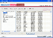
Do you want to recover MDB records?
Do you want to recover Mdb records? if yes, then get Recover data for Access Recovery software. It recover records fields such as Field Name, Data Type, Description, Filed properties, Customer Id, Company Name, Contact Name, Contact Title & other object from corrupted ,damaged, inaccessible, unreadable Mdb files. By using Mdb record data recovery appreciable software...
Category: Web Authoring / Site Management
Publisher: Access Record Recovery, License: Shareware, Price: USD $99.00, File Size: 1.8 MB
Platform: Windows
Shape Viewer is a free tool, which you can use to view ESRI Shape files.
Shape Viewer is a free tool, which you can use to view ESRI Shape files.
Shape Viewer can open (.Shp) files that contain the geometry information of the shape file.With Shape Viewer you can also create new (.shx) file, and new empty (.dbf) file for your shape file.
If you have hundreds of shape files, and you want to view their contents rapidly, and you don't want to...
Category: Multimedia & Design / Graphics Viewers
Publisher: Mohammed Hammoud, License: Freeware, Price: USD $0.00, File Size: 35.0 KB
Platform: Windows
GeoSurveillance is software that combines spatial statistical routines with some basic Geographic Information Systems (Gis) functions to carry out retrospective and prospective statistical tests for the detection of geographic clustering. In this software, the focus is primarily on the spatial statistical analysis. Consequently, full Gis functionality is not provided. Gis...
Category: Home & Education / Miscellaneous
Publisher: NCGIA, License: Freeware, Price: USD $0.00, File Size: 2.4 MB
Platform: Windows