Free Downloads: Drawing Maps Software
openCanvas is a paint/drawing software that enables you to record/replay your drawing procedure.
openCanvas is a paint/Drawing Software that enables you to record/replay your Drawing procedure.
If you use the "Event" function (to replay the Drawing process), it is quite easy to find out how an illustration was created!
openCanvas has a simple interface, nice and realistic brush stroke, and various filters/layers/tones.
openCanvas will...
Category: Multimedia & Design / Digital Media Editors
Publisher: portalgraphics.net, License: Shareware, Price: USD $81.29, File Size: 2.2 MB
Platform: Windows
Euratlas Periodis Expert is a database and a historical atlas of Europe with editing functions.
Euratlas Periodis Expert is a database and a historical atlas of Europe with editing functions. It describes the political status of Europe, North Africa and Near East at fixed intervals, from year 1 until year 2000.
Stress is put on the precise Drawing of territories at one exact instant defined by fixed length intervals, that is the first day of each centennial year.
...
Category: Home & Education / Miscellaneous
Publisher: Euratlas, License: Shareware, Price: USD $77.80, File Size: 33.2 MB
Platform: Windows
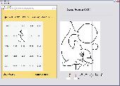
A fun and interactive Software program for those who want to learn how to draw. It combines a classic learning technique with the power of a computer, creating a fun and interactive game. It offers 25 Drawing exercises for your Drawing practice. Best of all, the program acts as your personal art teacher - it will check each of your drawings and indicate which areas need...
Category: Home & Education / Teaching Tools
Publisher: Caricature Software, License: Shareware, Price: USD $19.95, EUR14.95, File Size: 3.9 MB
Platform: Windows
PlanetGIS Explorer is a free viewer for PlanetGIS maps and GIS exchange files.
PlanetGIS Explorer is a free viewer for PlanetGIS Maps and GIS exchange files. PlanetGIS Explorer allows you to navigate through Maps, query map elements and view attribute information from linked database tables. Also PlanetGIS Explorer allows you to customize the appearance of Maps for purposes of creating hardcopy printouts, but does not allow you to save any changes to...
Category: Multimedia & Design / Graphics Viewers
Publisher: Planet GIS, License: Freeware, Price: USD $0.00, File Size: 5.4 MB
Platform: Windows
 Shareware
Edraw Max is a vector-based diagramming Software with rich examples and templates. Easy to create flow charts, organizational charts, business process, UML diagrams, work flows, program structures, network diagrams, chart and graphics, mind map, directional Maps and database diagrams. With pre-drawn libraries and more than 4600 vector symbols, Drawing couldn't be easier!...
Category: Multimedia & Design / Image Plugins
Publisher: Cucusoft Inc., License: Shareware, Price: USD $99.95, File Size: 6.1 MB
Platform: Windows
Shareware
FPS Maps for WPF is a brand new component with a set of built-in country Maps. There are 15 Inbuilt Countries. FPS Maps for WPF contains samples of how to work with it and customize. Maps navigation can be performed via Navigation bar which supports Themes and mouse. You can pan with mouse or zoom in/out with mouse scroll. More options will be added in future...
Category: Software Development / Components & Libraries
Publisher: FPS Components, License: Shareware, Price: USD $199.00, File Size: 1.1 MB
Platform: Windows

Paint online bear. Demonstrations, hints, tips and books. How to Draw Storyboards. Heres the place to start if you dont know the conventions of storyboarding. Or perhaps youd like to use existing clipart and cut.Drawing hands tutorial - learn how to draw hands from life - a free, original online Drawing tutorial.Drawing - original Drawing lessons, how to draw...
Category: Games / Kids
Publisher: Paint online, License: Freeware, Price: USD $0.00, File Size: 10.0 KB
Platform: Windows, Mac
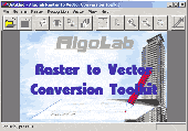
Software development kit for CAD/CAM/ GIS and graphic software developers.
Software development kit for CAD/CAM/ GIS and graphic Software developers. Converts from raster to vector and refines architect, mechanical, tech Drawing, Maps, math graphs, graphics for books and journals and more. ActiveX and Com Component are also available. Refines vector graphics, creates fine lines and shapes. Scanned drawings are recognized and represented in...
Category: Software Development / Tools & Editors
Publisher: AlgoLab Inc., License: Shareware, Price: USD $0.00, File Size: 2.7 MB
Platform: Windows
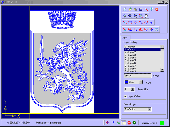
Vectorizer for CAD/CAM/GIS professionals, designers and illustrators. Available also as Raster to Vector SDK, ActiveX and Com Component. Converts, digitizes and refines architectural, mechanical, various technical drawings, Maps, math graphs, graphics for books and journals and more from raster to vector. Digitizes math graphics. Also refines vector graphics, creates fine lines and...
Category: Multimedia & Design / Image Editing
Publisher: Algolab, License: Shareware, Price: USD $99.00, File Size: 1.7 MB
Platform: Windows
TopoGun is a stand-alone resurfacing, and maps baking application.
TopoGun is a stand-alone resurfacing, and Maps baking application. The resurfacing functions in TopoGun will help you modify and/or recreate the edgeflow of your digital 3D models.
The Maps baking functions, will help you bake various types of texture Maps from your high resolution 3D models and then allow you to apply them to your newly created optimized...
Category: Multimedia & Design / Animation
Publisher: SC PIXELMACHINE SRL, License: Shareware, Price: USD $100.00, File Size: 55.5 MB
Platform: Windows
There has never been a more comprehensive, powerful, all-in-one Software solution that provides an easy-to-use and intuitive user interface for digitizing, geographic referencing, reprojection, tiling, and mosaicking.
Didger solves the problem of combining data files in different coordinate systems, by providing extensive tools to transform the data into one cohesive...
Category: Home & Education / Miscellaneous
Publisher: Golden Software, License: Shareware, Price: USD $0.00, File Size: 0
Platform: Windows
MTS TOPCAD is a software used for drawing sketches.
MTS TOPCAD is a Software used for Drawing sketches. The Software can be downloaded from the download section of the website. After you open a Drawing file the menu will be available and you can modifiy the contents of the draw just how you like it. The Software is free to use!
Category: Multimedia & Design / Image Editing
Publisher: MTS GmbH Berlin, License: Shareware, Price: USD $250.00, File Size: 12.0 MB
Platform: Windows
MapCreator combines a cartography and a graphics programme.
MapCreator combines a cartography and a graphics programme. The Software is designed to create Maps and animated Maps of the highest quality as often required for presentations. For example, this could be Maps needed for a travel presentation. But also in
Category: Multimedia & Design
Publisher: primap.com, License: Freeware, Price: USD $0.00, File Size: 103.3 MB
Platform: Windows, Vista
You can create a backup of your maps with JaVaWa GMTK and restore these (e.
You can create a backup of your Maps with JaVaWa GMTK and restore these (e.g. on another computer) including unlock codes. Re-installing Maps is unnecessary.
Migration of your Garmin Maps from and old computer to a new one is straightforward with this application.
Category: Utilities / Backup
Publisher: JaVaWa GPS-tools, License: Shareware, Price: USD $0.00, File Size: 5.4 MB
Platform: Windows
W4MapLauncher is a free software application that contains more than 85 standard maps of W4.
W4MapLauncher is a free Software application that contains more than 85 standard Maps of W4.This Software application allows you to play on the new Maps in multiplayer or on-line.This launcher has also an aspect mode of 4:3 and 16:10, it is easy to install and to use
Category: Games / Misc. Games
Publisher: AlexBond, License: Freeware, Price: USD $0.00, File Size: 23.8 MB
Platform: Windows
R2V is a tool for converting raster images to vector by Drawing centerlines and outlines. R2V converts architect, mechanical and various technical drawings, Maps and other types from raster to vector format. A vector format can be imported into your CAD/CAM or Drawing program. R2V supports the Bmp and Jpeg raster format. The output vector file can be saved in DXF (Autocad),...
Category: Multimedia & Design
Publisher: MR Soft, License: Shareware, Price: USD $42.00, File Size: 1.6 MB
Platform: Windows
Live Satellite Maps or Google maps is a web server mapping applications.
Live Satellite Maps or Google Maps is a web server mapping applications.Provides scrolling map images and satellite photos around the earth and even the route between different places.Since 6 October 2005, live satellite Maps is part of local Google.Google live satellite Map provides the ability to zoom in or zoom out to show the map.The user can control the map with your...
Category: Home & Education / Science
Publisher: www.satelliteview-of-my-house.com, License: Freeware, Price: USD $0.00, File Size: 643.0 KB
Platform: Windows
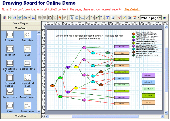
Drawing Board ActiveX Control acts as a Drawing board for creating online Drawing programs rapidly. The OCX is lightweight and flexible, and gives developers new possibilities for Drawing flowcharts, organizational charts, workflow, network diagrams and other business charts in a form or web page. You can custom the toolbars and template library according your...
Category: Software Development / ActiveX
Publisher: Any Draw, License: Shareware, Price: USD $299.95, File Size: 1.5 MB
Platform: Unknown
Single State Mapping Tool allows you to create Maps of individual states with Microsoft® MapPoint® 2002, 2004 or 2006. Make Maps of individual states. For various purposes, many users of Microsoft MapPoint would like to cover up neighboring states for their Maps in Microsoft MapPoint. This tool allows you to do that. Demo data file allows you to create an individual...
Category: Business & Finance
Publisher: MP2KMag and Winwaed Software Technology LLC, License: Data Only, Price: USD $75.00, File Size: 1.4 MB
Platform: Windows
Shareware
GPS Mapping Software for Windows, Loading topographic Maps, realtime navigation, track recording, manage GPS devices and more. The Software can be used with various map formats including: GeoTiff, BSB Nautical Charts, AutoCad DXF files, ESRI Shapefiles. Using calibration you can also use scanned or downloaded JPG, BMP, GIF, PNG and TIF Maps. The Software can...
Category: Home & Education / Science
Publisher: Eye4Software B.V., License: Shareware, Price: USD $149.00, EUR99, File Size: 11.1 MB
Platform: Windows
CompeGPS is an essential Software to make the most of your GPS. With this PC Software you will be able to download a wide variety of cartography from the internet and also analyse your routes. This Software has been specially designed for free flight and motor flight pilots they use GPS and likes to create and accomplish their own routes and then later on analyse....
Category: Home & Education
Publisher: CompeGPS TEAM S.L., License: Shareware, Price: USD $106.00, File Size: 14.9 MB
Platform: Windows
ArcGIS for AutoCAD is a free, downloadable plug-in application for AutoCAD that provides improved interoperability between AutoCAD and ArcGIS. Within the AutoCAD environment, you gain easy access to enterprise GIS Maps hosted by ArcGIS Server.
In addition, ArcGIS for AutoCAD gives you the ability to prepare CAD data for use with the ArcGIS system while leveraging your...
Category: Multimedia & Design / Image Editing
Publisher: Environmental Systems Research Institute, Inc., License: Demo, Price: USD $0.00, File Size: 1.4 MB
Platform: Windows
Microsoft MapPoint Software gives you the power to turn tabular data into informative Maps to communicate insights with instant impact. You can easily integrate Maps into your Office projects to show your business insights with clarity. Plus, get updated Maps of the US and Canada, with trip routing, turn-by-turn directions, and the ability to share routes with your...
Category: Business & Finance / MS Office Addons
Publisher: Microsoft, License: Shareware, Price: USD $0.00, File Size: 0
Platform: Windows
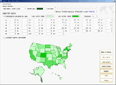
Region Map Generator is a tool to make region map with self-definition color. The original Maps in the Software are blank political region ones for different countries or areas. You can color any region with whatever color as you like. By this Software, you can easily make lively Maps. These Maps can be used as data analysis charts, teaching materials,...
Category: Business & Finance / Applications
Publisher: cciyy, License: Shareware, Price: USD $36.95, File Size: 1.3 MB
Platform: Windows
Nokia Maps 3D browser plugin is a free mapping product and service by Nokia for its mobile phones and for internet browsers. Nokia Maps includes voice guided navigation for both pedestrians and drivers for 74 countries in 46 different languages and there are Maps for over 180 countries.
See the world in high-resolution 3D. Everything from the sky to the street. Plan...
Category: Internet / Browser Accessories
Publisher: Nokia, License: Freeware, Price: USD $0.00, File Size: 9.8 MB
Platform: Windows